Discover the World: Top 10 Unbelievable Fun Facts About Atlas You Never Knew!

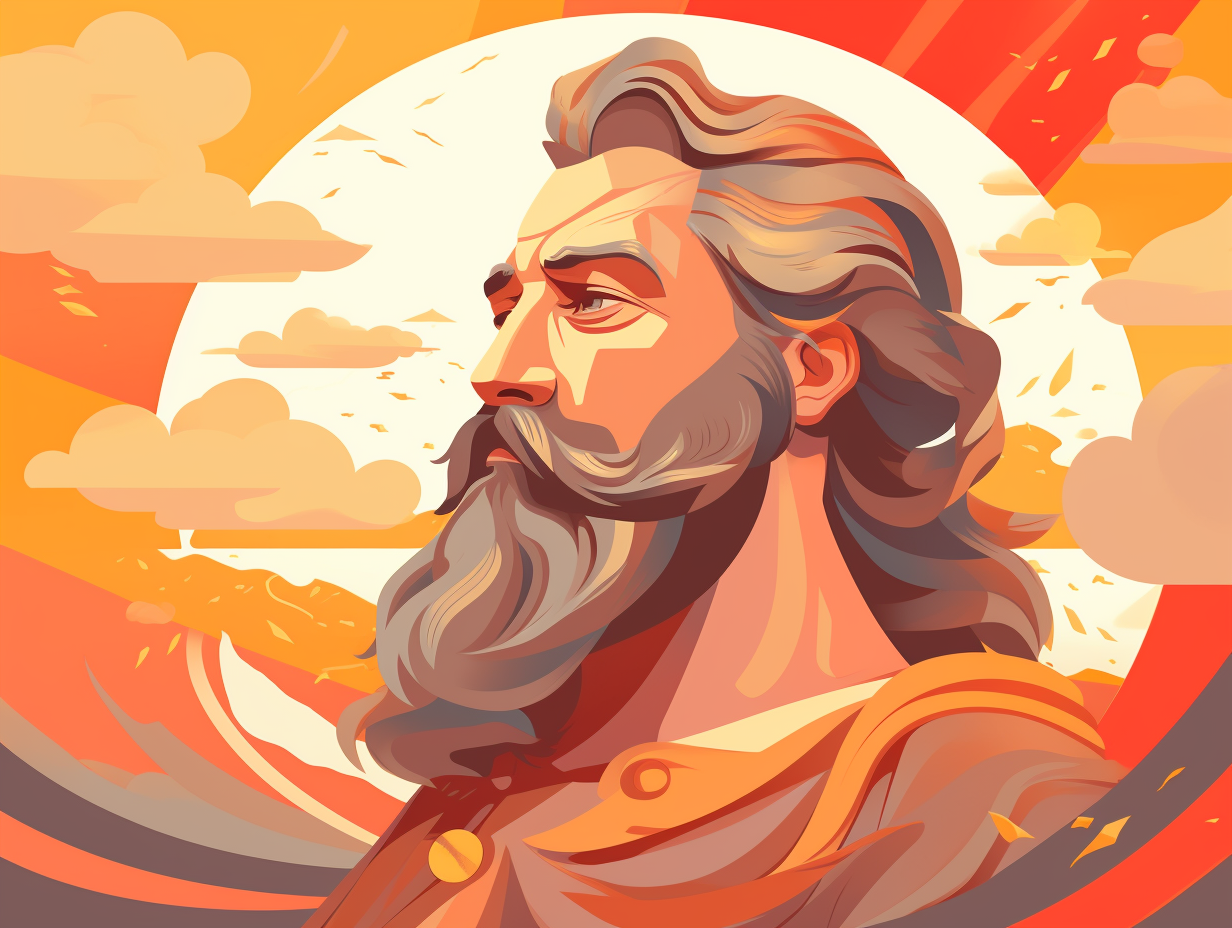
1. Atlas: The Buff Celestial Mapmaker
Who needs a compass when you have a Titan who's also a celestial map-maker extraordinaire? That's right, we're talking about Atlas, the original stargazer: This buff mythological figure excelled in philosophy, mathematics, and astronomy, even inventing the first celestial sphere and possibly astronomy itself! As if that wasn't enough, Atlas was said to reside at the ends of the earth in extreme west and later became synonymous with the Atlas Mountains in northwest Africa, where he supposedly ruled as the first King of Mauretania. So let's raise a toast to this astral architect next time we're stargazing!
Source => en.wikipedia.org
2. Gerardus Mercator: The Personal Trainer of Maps
Who knew maps had a personal trainer: Gerardus Mercator, the genius behind the Mercator projection, also bulked up the world of cartography by inventing the concept of an "atlas"! This new name was inspired by the Greek mythological stud Atlas, flexin' his muscles to support the entire world. Our cartographic pioneer didn't skip leg day either, as Mercator continued to expand his atlas collection up until he passed away in 1594.
Source => nationalgeographic.org

Did you know that Zeus and Hera's celestial marriage was like a cosmic soap opera, filled with Zeus' infidelity and Hera's vengeful jealousy? Discover more intriguing facts about Greek mythology!
=> Fun Facts about Greek-Mythology
3. Atlas Minor: The iPhone of Cartography
Before GPS and Google Maps, there was the iPhone of cartography: Gerardus Mercator's Atlas minor from 1607! This compact and affordable travel buddy was actually called a "pocket atlas," and squeezed 126 maps into its conveniently portable package, leaving the big, bulky folio atlases in the dust. Gerardus was the Apple Maps of his time, with his Typus Orbis Terrarum touted as one of the most accurate representations of the world back then.
Source => exhibits.stanford.edu
4. Earth Platinum: The World's Heaviest Atlas
Next time you're feeling the weight of the world on your shoulders, just remember: that's barely half the weight of the world's largest atlas the Earth Platinum: This colossal compendium tips the scales at 150 kilograms (330 lb) and takes two people to turn each of its 128 massive pages that feature gigantic orthographic maps, gigapixel photographs, and a 272-gigapixel Shanghai skyline stitched from 12,000 images. Only 31 limited edition copies were printed, with each atlas selling for a mind-boggling $100,000.
Source => en.wikipedia.org

5. Ptolemy's World Map: Celestial Navigation Pioneer
Before latte-eager explorers frequented coffee shops with crumb-laden paper napkin maps, seasoned navigators relied on a colossal classic: Ptolemy's world map, a 2nd-century masterpiece, was the first of its kind to employ longitudinal and latitudinal lines, as well as celestial observations to pinpoint earthly locations, ultimately catalyzing the Roman Empire's eastern expansion and Indian Ocean trade.
Source => en.wikipedia.org
6. Abraham Ortelius: The Trailblazer of Modern Atlases
Before Google Maps was a twinkle in the internet's eye, and explorers had to consult something called "paper" to find their way: Abraham Ortelius became the innovative trailblazer of cartography with the publication of his Theatrum Orbis Terrarum in 1570. This ground-breaking first modern world atlas featured 53 maps, including an original world map, and fully credited his sources – talk about academic integrity! Ortelius's publishing success led to 23 editions and translations of the atlas, allowing him to travel and refine his maps – a 16th-century globe-trotting legend!
Source => lindahall.org
7. Rungholt: The "Atlantis of the North Sea"
Who needs a GPS in Atlantis when you can just listen for the bells to guide your way: Rungholt, a sunken settlement in modern-day Germany, is often called the "Atlantis of the North Sea" because it mysteriously vanished beneath the waves over 700 years ago. Legend has it that on a calm night, sailors can still hear the ghostly church bells ringing, acting as a creepy maritime serenade for this long-lost city.
Source => mirror.co.uk
8. John Flamsteed: The Astronomer Who Mapped the Stars
In the era when stargazing was more than a cheap date activity, John Flamsteed stepped up to create the celestial equivalent of Google Maps for sailors: His Atlas Coelestis, published in 1729, was the most accurate stargazers' guide of its time, featuring 25 maps of constellations and two planispheres based on 3,000 observations from the Royal Observatory at Greenwich, where he held the first "Astronomer Royal" title.
Source => rct.uk
9. Johann Bayer: The OG Star-namer
You know that friend who insists on making up overly complicated nicknames for everyone in the group? Well, turns out they might have a career in astronomy! In 1603, Johann Bayer was the OG of naming stars, which resulted in Alpha Tauri and friends: Bayer's Uranometria introduced a groundbreaking system of stellar nomenclature that assigned Greek and Roman letters to stars within constellations based on their relative brightness. This not only standardized astronomy practices but also solidified the Uranometria's spot as one of the first modern star atlases, still influential today.
Source => raremaps.com

10. Tabula Peutingeriana: Ancient Rome's Stretch Limo GPS
If ancient Romans had a GPS, it would be as long as a stretch limo and called the Tabula Peutingeriana: a unique parchment map from around 1200 CE, measuring 6.75 meters long and 0.35 meters high, featuring over 555 cities and 3,500 place names across Europe, North Africa, and parts of Asia, designed to provide a practical overview of the empire's road network and adorned with iconic decorations of Rome, Constantinople, and Antioch.
Source => en.wikipedia.org
Related Fun Facts